TEREVUE CORE
Category Archives: Terrain

Navigating Weather and External Force Threats in Pipeline Integrity: Key Insights from Industry Leaders
On March 3, 2025, Teren hosted an expert panel in Houston, bringing together leading pipeline [...]
10
Apr
Apr
API RP 1187 Recommended Practice for Managing Landslide Hazards for Pipeline Integrity Explained, and How to Implement
Introduction to API Recommended Practices Landslides are complex geological phenomena that can have devastating effects [...]
26
Feb
Feb
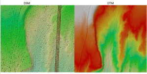
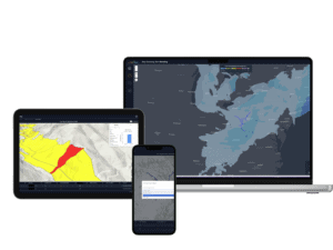
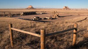
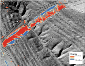
Strange Bumps in the DTM: How Teren’s LiDAR Analytics Helped A Renewable Energy Investor See the True Terrain
We think there are holes in the digital terrain model. That’s what an engineering firm [...]
24
Jan
Jan
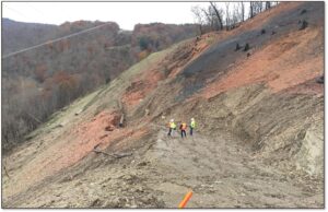
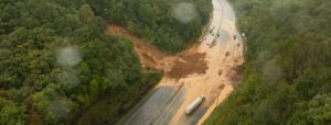
Debris Flows: Understanding Nature’s Destructive Geological Phenomenon
Introduction Nature has few forces as swift and destructive as debris flows. These geological phenomena [...]
11
Dec
Dec
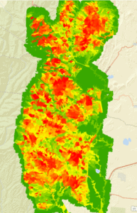
Predicting Landslides: Teren’s Hydrology Modeling Validated by Hurricane Helene
In the wake of Hurricane Helene, Teren worked with USGS data to validate its innovative [...]
26
Nov
Nov
Building Transportation Resilience: 5 Key Analytics to Manage Increasing Environmental Threats
In today’s rapidly changing climate, transportation infrastructure faces growing challenges from environmental and climate-related hazards. [...]
11
Nov
Nov
Enhancing site suitability surveying: 5 key spatial data approaches for pre-construction site engineers and surveyors
For site engineers and surveyors, pre-construction surveying is a critical phase that sets the stage [...]
29
Oct
Oct
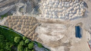
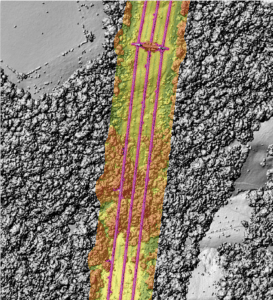
Transforming Well Pad Reclamation in Colorado’s DJ Basin
Learn how a major oil and gas producer has leveraged Teren’s environmental intelligence to become [...]
24
Oct
Oct
10 Game-Changing Analytics for Modern Forestry and Land Stewardship
In the ever-evolving field of land and forestry management, the ability to analyze and interpret [...]
08
Oct
Oct
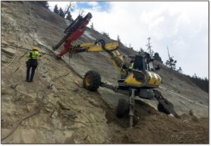
Slope Stability Explained, and It’s Relationship with Landslides
Have you ever wondered what makes a grassy hillside stay put instead of sliding down [...]
27
Aug
Aug
These are the top 7 analytics you should be tracking to protect your utilities against the environment
Evolving Environmental Threats Require Advanced Analytics As environmental factors increasingly impact utility infrastructure, integrating advanced [...]
23
Aug
Aug
Enhancing Pipeline Inspection Efficiency in the Midwest through Remotely-Sensed Data: A Case Study
With many miles to inspect and a tight deadline, Teren helped the operator swiftly identify [...]
22
Jun
Jun
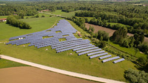
5 Hidden Costs of Bad Data in Renewable Development
From estimating earthworks to designing array layouts, LiDAR plays a crucial role in determining the [...]
17
May
May
Sign Up for Spring: Top FAQ’s About Teren’s Content Regions
Teren's Spring 2023 Appalachia LiDAR collection is starting soon. Sign up today to get critical [...]
21
Mar
Mar
Teren Expands Content Region Footprint to Include Oklahoma and Arkansas Data
Teren, the climate resilience data and analytics company, today announced it has expanded its analytics [...]
14
Dec
Dec

Don’t Be Left Out In the Cold: Teren Prepares for Fall Appalachia LiDAR Collection
Teren's Fall 2022 Appalachia LiDAR collection is the best and fastest way to get high-fidelity [...]
03
Nov
Nov
Webinar: Gain a Competitive Advantage
With Teren, engineering firms and developers can access high-fidelity LiDAR and decision-ready analytics to gain [...]
16
Sep
Sep

Top 4 Analytics for Renewable Developers
Renewable developers are in a hard space. On the one hand, they are in a [...]
06
Jul
Jul
Wildfire and Water: Grant Awarded to Examine Sedimentation Impacts in Poudre River Watershed
The Poudre River Watershed is a source for drinking water, recreation, and ecosystem functionality in [...]
19
Feb
Feb