TEREVUE CORE
Category Archives: Soil

Navigating Weather and External Force Threats in Pipeline Integrity: Key Insights from Industry Leaders
On March 3, 2025, Teren hosted an expert panel in Houston, bringing together leading pipeline [...]
10
Apr
Apr
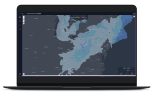
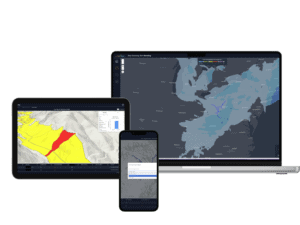
TEREN LAUNCHES TEREVUE TO REVOLUTIONIZE ENVIRONMENTAL RISK MANAGEMENT FOR INFRASTRUCTURE OPERATORS WITH REAL-TIME GEOSPATIAL INTELLIGENCE
New SaaS Product Is the First and Only Technology Offering System-wide Intelligent Alerting of Potential [...]
05
Mar
Mar
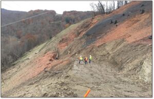
API RP 1187 Recommended Practice for Managing Landslide Hazards for Pipeline Integrity Explained, and How to Implement
Introduction to API Recommended Practices Landslides are complex geological phenomena that can have devastating effects [...]
26
Feb
Feb
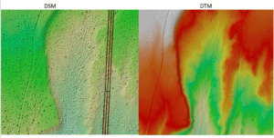
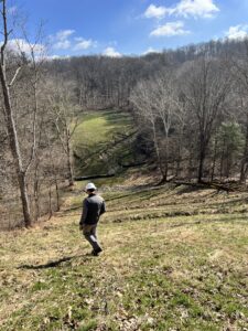
Strange Bumps in the DTM: How Teren’s LiDAR Analytics Helped A Renewable Energy Investor See the True Terrain
We think there are holes in the digital terrain model. That’s what an engineering firm [...]
24
Jan
Jan
Debris Flows: Understanding Nature’s Destructive Geological Phenomenon
Introduction Nature has few forces as swift and destructive as debris flows. These geological phenomena [...]
11
Dec
Dec
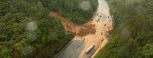
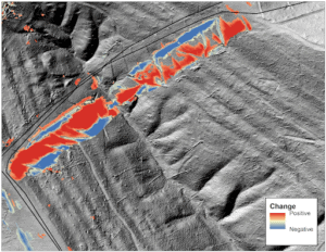
Predicting Landslides: Teren’s Hydrology Modeling Validated by Hurricane Helene
In the wake of Hurricane Helene, Teren worked with USGS data to validate its innovative [...]
26
Nov
Nov
Enhancing site suitability surveying: 5 key spatial data approaches for pre-construction site engineers and surveyors
For site engineers and surveyors, pre-construction surveying is a critical phase that sets the stage [...]
29
Oct
Oct
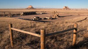
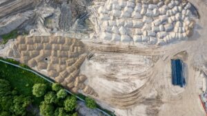
Transforming Well Pad Reclamation in Colorado’s DJ Basin
Learn how a major oil and gas producer has leveraged Teren’s environmental intelligence to become [...]
24
Oct
Oct
From Polar Bears to Landslides: A Geomorphologist’s Quest to Solve Nature’s Greatest Mysteries Through Soil
In his 25+ years as a geomorphologist, soil scientist and quantitative spatial ecologist, John Norman [...]
02
Oct
Oct
Slope Stability Explained, and It’s Relationship with Landslides
Have you ever wondered what makes a grassy hillside stay put instead of sliding down [...]
27
Aug
Aug
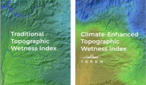
Elevating the Traditional Topographic Wetness Index with Teren’s Climate-Enhanced TWI
What is TWI? The Topographic Wetness Index (TWI) has long been a staple in modeling [...]
16
Jul
Jul

From Fire to Future: Using Spatial Analysis Tools for Wildfire Recovery in New Mexico
Wildfires: Balancing Prevention with Post-Fire Response With the ever-expanding 2024 wildfire season is off to [...]
02
Jul
Jul
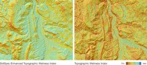
Teren Awarded USDA Grant to Improve TWI Measure for Soil and Vegetation Delineation
Award from the USDA Natural Resources Conservation Service Teren is pleased to announce our pending [...]
20
Jan
Jan
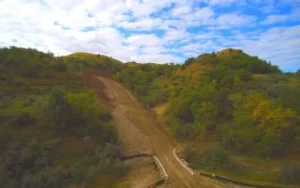
How Soil Movement Impacts Right-of-Way Integrity
How does soil movement impact pipeline and right-of-way integrity? Traditional integrity management focuses on the [...]
11
Jun
Jun