TEREVUE CORE

Navigating Weather and External Force Threats in Pipeline Integrity: Key Insights from Industry Leaders
On March 3, 2025, Teren hosted an expert panel in Houston, bringing together leading pipeline [...]
10
Apr
Apr

Announcing Our Strategic Collaboration with Woolpert
When you set out to be the best at providing accurate, timely and actionable environmental [...]
03
Apr
Apr

Teren Joins the Colorado-Wyoming Climate Resilience Engine Digital Twin Accelerator
Teren has been selected to participate in the inaugural Colorado-Wyoming Climate Resilience Engine Digital Twin [...]
19
Mar
Mar
From Backlog to Back-on-Track: Automating Solar Site Pre-Screening & Processing with Teren’s Hydrology/Veg Intelligence (Customer Story)
The Problem Renewable energy suppliers are in a race to efficiently and accurately identify viable [...]
19
Mar
Mar
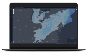
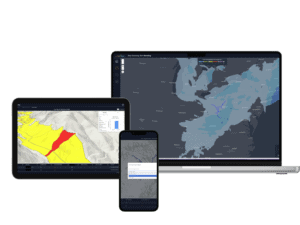
TEREN LAUNCHES TEREVUE TO REVOLUTIONIZE ENVIRONMENTAL RISK MANAGEMENT FOR INFRASTRUCTURE OPERATORS WITH REAL-TIME GEOSPATIAL INTELLIGENCE
New SaaS Product Is the First and Only Technology Offering System-wide Intelligent Alerting of Potential [...]
05
Mar
Mar
API RP 1187 Recommended Practice for Managing Landslide Hazards for Pipeline Integrity Explained, and How to Implement
Introduction to API Recommended Practices Landslides are complex geological phenomena that can have devastating effects [...]
26
Feb
Feb

The Evolution and Applications of Environmental Twin Technology: Webinar Insights
This article follows up on insights shared during the Pennsylvania Geospatial Coordinating Board’s recent webinar [...]
05
Feb
Feb
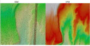
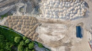
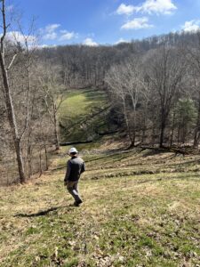
Strange Bumps in the DTM: How Teren’s LiDAR Analytics Helped A Renewable Energy Investor See the True Terrain
We think there are holes in the digital terrain model. That’s what an engineering firm [...]
24
Jan
Jan
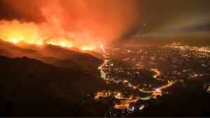
Understanding Post-Wildfire Hazards & Insurance Implications: A Conversation with Leading Geomorphologist John Norman
As wildfires like the recent ones in Los Angeles become increasingly prevalent across our landscapes, [...]
14
Jan
Jan
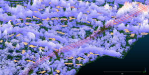
Pipeline Integrity Management: Protecting Critical Infrastructure from Natural Force Threats
Introduction Pipeline infrastructure serves as the backbone of global energy networks, delivering the resources that [...]
17
Dec
Dec
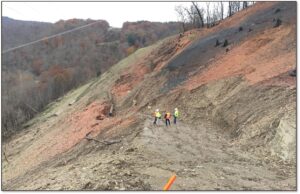
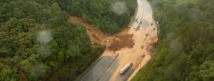
Debris Flows: Understanding Nature’s Destructive Geological Phenomenon
Introduction Nature has few forces as swift and destructive as debris flows. These geological phenomena [...]
11
Dec
Dec
8 Ways Geospatial Data Transformed Business Applications in 2024
Geospatial data has transformed the way humans and businesses interact and engage. By leveraging the [...]
09
Dec
Dec
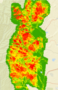
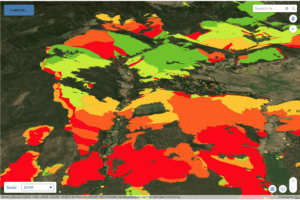
Predicting Landslides: Teren’s Hydrology Modeling Validated by Hurricane Helene
In the wake of Hurricane Helene, Teren worked with USGS data to validate its innovative [...]
26
Nov
Nov
Building Transportation Resilience: 5 Key Analytics to Manage Increasing Environmental Threats
In today’s rapidly changing climate, transportation infrastructure faces growing challenges from environmental and climate-related hazards. [...]
11
Nov
Nov
Spooky Sightings from Above: Our Favorite Haunted Data Sets
Mappy Halloween from Teren! This October, we’re celebrating the spooky side of geospatial data. From [...]
31
Oct
Oct
Enhancing site suitability surveying: 5 key spatial data approaches for pre-construction site engineers and surveyors
For site engineers and surveyors, pre-construction surveying is a critical phase that sets the stage [...]
29
Oct
Oct
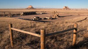
Transforming Well Pad Reclamation in Colorado’s DJ Basin
Learn how a major oil and gas producer has leveraged Teren’s environmental intelligence to become [...]
24
Oct
Oct
10 Game-Changing Analytics for Modern Forestry and Land Stewardship
In the ever-evolving field of land and forestry management, the ability to analyze and interpret [...]
08
Oct
Oct
Policy Update: Two Major Legislative Wins for Wildfire Technology & Management
The wildfire management policy landscape is evolving rapidly with two recent significant legislative advancements at [...]
03
Oct
Oct
From Polar Bears to Landslides: A Geomorphologist’s Quest to Solve Nature’s Greatest Mysteries Through Soil
In his 25+ years as a geomorphologist, soil scientist and quantitative spatial ecologist, John Norman [...]
02
Oct
Oct