We think there are holes in the digital terrain model.
That’s what an engineering firm flagged to Teren’s customer, a renewable energy investor, when they received Teren’s advanced LiDAR and analytics for a project on a solar generation facility out in Southeast New Mexico.
Teren’s work with the renewable energy investor started early 2024 to provide environmental intelligence and geospatial insights tailored to complex renewable energy projects. To maintain their investment edge, the investor harnesses Teren’s geotech and analytics to get accurate, site-specific environmental data to manage risk and maintain project integrity.
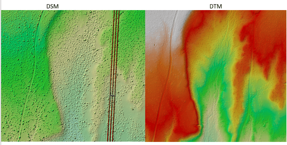
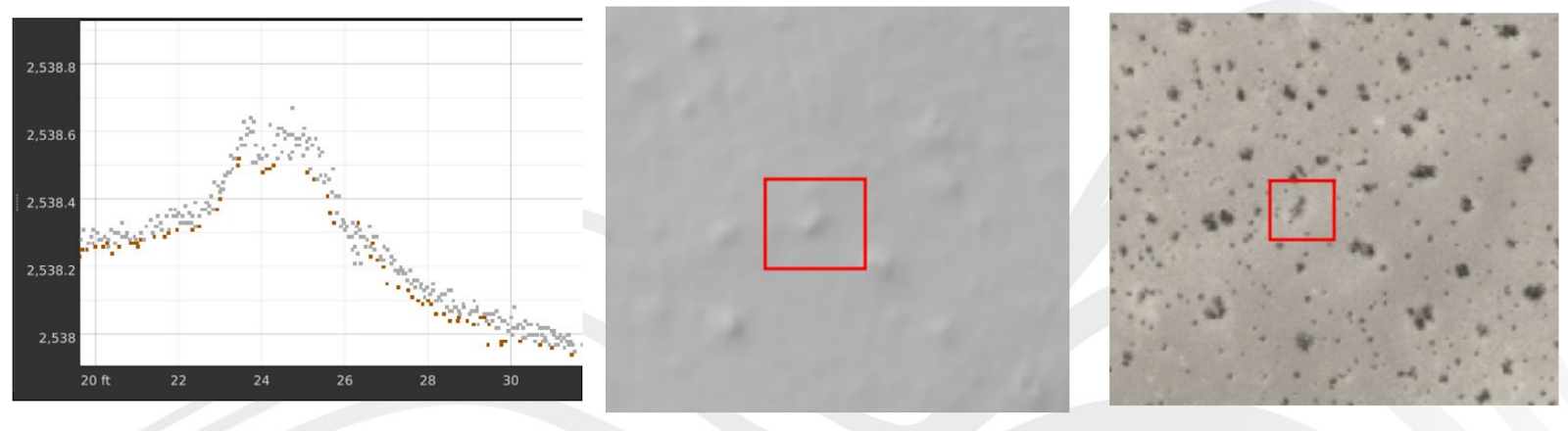
For this particular project in New Mexico, Teren had collected, processed and analyzed the data, but the engineering firm co-working on the project voiced its doubts. Seeing strange bumps in the digital terrain model (DTM) delivered by Teren, they raised concerns on potential holes in the data, or unremoved vegetation.
So, who was right?
Unearthing the Truth
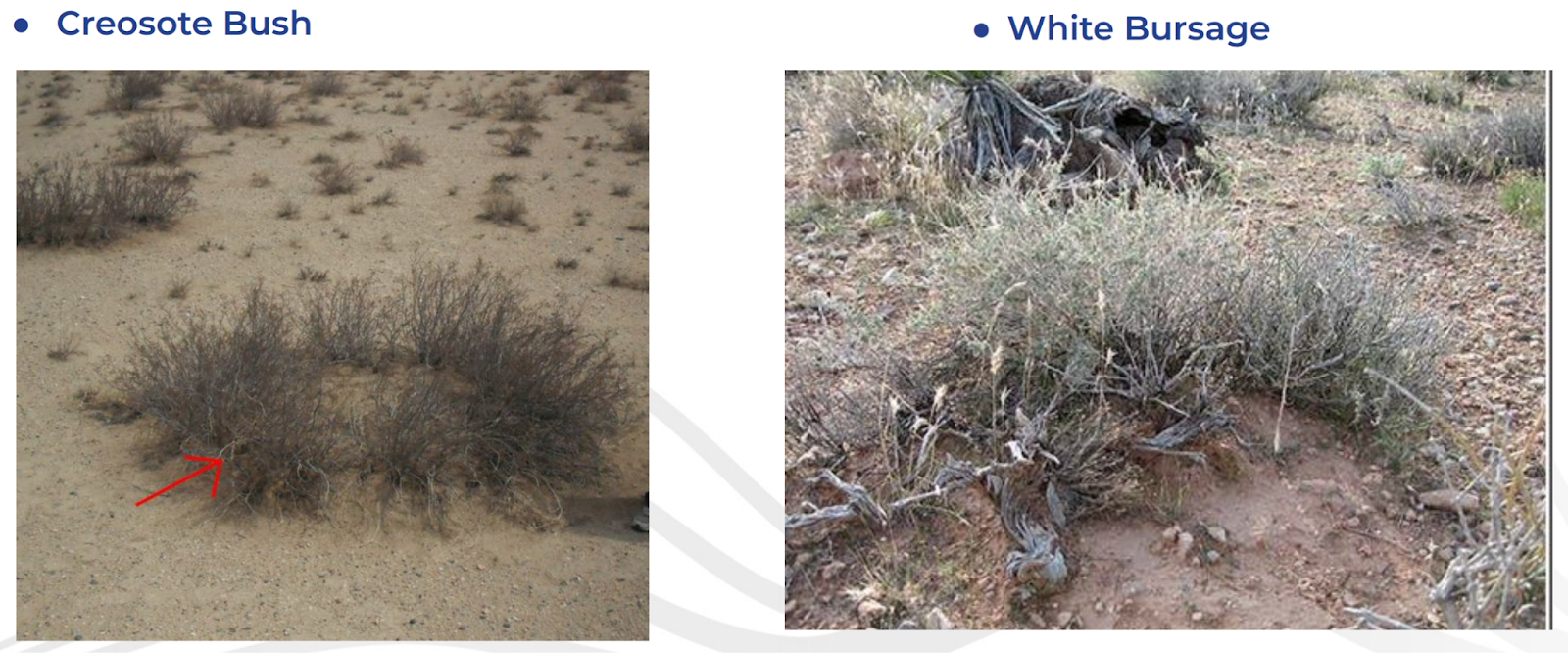
The reality, said Teren’s Director of Operations Austin Savage, was that at the resolution that Teren was capturing (1.4ft), the topography was not smooth. And what everyone thought was unremoved vegetation, was in fact a dirt mound underneath the shrub – a mosquito mound – a well documented phenomenon for vegetation in the area.
In LiDAR We Trust
With Teren’s thorough analysis and explanation in hand, the renewable energy investor and its engineering partners needed visual confirmation.
They hopped on a plane and went to visit the Southeast New Mexico project.
Low and behold, they found mosquito mounds in the sand, as far as the eye could see.
In Teren We Trust
The validation impressed both the renewable energy investor and their engineering partners.
Armed with Teren’s environmental intelligence, the renewable energy investor continues to enjoy Teren’s Vegetation and Hydrology Data Suites to accurately assess projects for potential hazards, maintaining the balance of risk and reward crucial to their investment model.
How can Teren help you?
We'd love to hear from you.
- Ready to dive deeper? -
Knowledge Hub
White Papers
Webinars