For site engineers and surveyors, pre-construction surveying is a critical phase that sets the stage for a smooth construction process. Leveraging advanced analytics of grade, hydrology, soils, and vegetation can create highly useful “constructability” metrics that drive decision making for the rest of the project. Let’s explore 5 key spatial data approaches that can make a substantial difference in pre-construction surveying.
1. Remotely-sensed Elevation and LiDAR Based Topographic Modeling
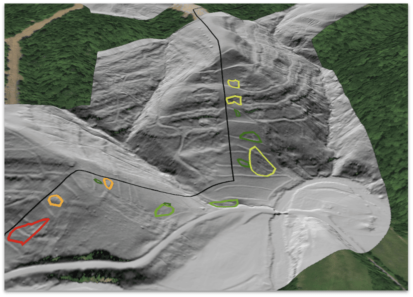
More than just elevation and contours, sophisticated terrain analytics can identify potential challenges related to site grading, flooding risk, drainage, and overall landscape planning. Data collection for topographic analysis has shifted from sparse metal in surveys to advanced collection of 3D point clouds of the ground surface using UAVs, laser scanners (LiDAR) and advanced classification algorithms.
2. MultiHazard Risk Assessment

Conducting a thorough risk assessment is essential for identifying potential hazards associated with the site in question. This includes evaluating factors such as flood zones, landslide areas, or contamination risk. By understanding these risks, engineers can develop effective mitigation strategies and ensure that construction activities are carried out safely.
3. Creating a Digital Twin of your project
Integrating various geospatial data sources, such as satellite imagery, GIS and CAD data, helps create digital twins of the terrain on a project site. This integration allows for a more thorough evaluation of the site, facilitating better decision-making and more accurate planning throughout the life cycle of the project. It also aids in visualizing how the new construction will fit into the existing environment.
4. Site Layout and Constructibility Optimization
Modern LiDAR data offer multifaceted approaches to site construction constraints such as shading analysis, flooding risk, and natural hazard identification such as landslides and karst. Analytics can optimize the placement of construction elements and machinery on the site. Early screening activities using best available data sources allow for early staging of geospatial assets and facilitate growth during the design staging and allow gap analysis as the project evolves. Soil analysis is essential for determining the composition, stability, and drainage properties of the soil at the construction site. This analysis ensures that the foundation can adequately support the planned construction and helps in selecting appropriate foundation types and construction methods.
5. Environmental Impact Analysis

Assessing the potential environmental impacts of construction activities is crucial for compliance with regulations and protecting local ecosystems. Environmental impact analysis helps identify potential issues and develop strategies to minimize adverse effects on the environment.
Accuracy, Quality and Speed Don’t Have to Be Oxymorons.
While incorporating the above data into pre-construction surveying processes enhances accuracy, quality and reduces risks, it is often assumed in the pre-construction world that the more data you have to incorporate, the more it slows down site progress.
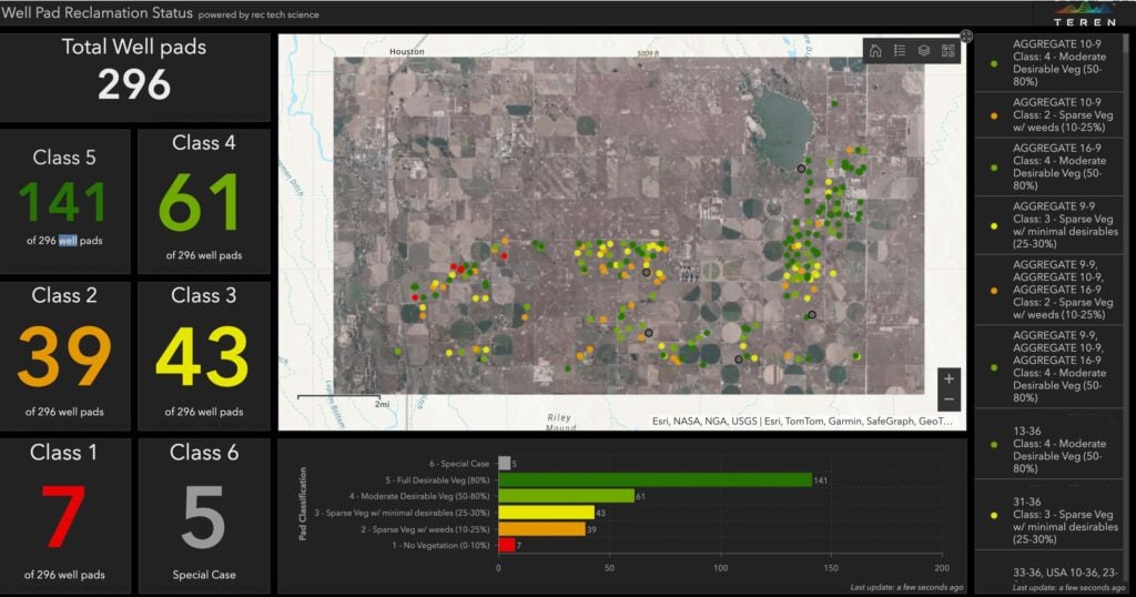
Teren’s Environmental Digital Twin has turned this theory on its head; it provides LiDAR data acquisition, processing and analysis to better estimate construction costs and material needs — at speed that keeps engineers and surveyors on schedule.


How can Teren help you?
We'd love to hear from you.
- Ready to dive deeper? -
Knowledge Hub
White Papers
Webinars