
Wildfires: Balancing Prevention with Post-Fire Response
With the ever-expanding 2024 wildfire season is off to a slow but steady start across North America, wildfires have become not a question of if, but when they will occur. While efforts to prepare for and prevent wildfires are important, efforts around rebuilding after a wildfire occurs are often too quickly forgotten, despite being crucial towards preventing future natural disasters like landslides, flooding, and future forest fires.
Just as for prevention, spatial analysis tools have been pivotal in wildfire recovery efforts. Through high-resolution data and advanced modeling techniques, more precise, cost-effective, and efficient approaches to rebuilding communities and restoring natural resources are possible.
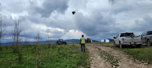
To see this in action, let’s take a look back at Teren’s recent work with the NRCS Conservation Effects Assessment Project on Grazing Lands (CEAP-Grazing Lands) and New Mexico NRCS field offices in the aftermath of the Hermits Peak and Calf Canyon fires.
Introduction: The Wildfire Catastrophe
In April 2022, New Mexico’s Sangre de Cristo Mountains were engulfed by a series of wildfires. Two significant fires, Hermits Peak and Calf Canyon, merged on April 22, becoming known as the Hermits Peak fire. This catastrophic event affected over 341,735 acres, driven by extreme, high-velocity winds uncommon to the area.
Road to Recovery: Using Technology to Rebuild
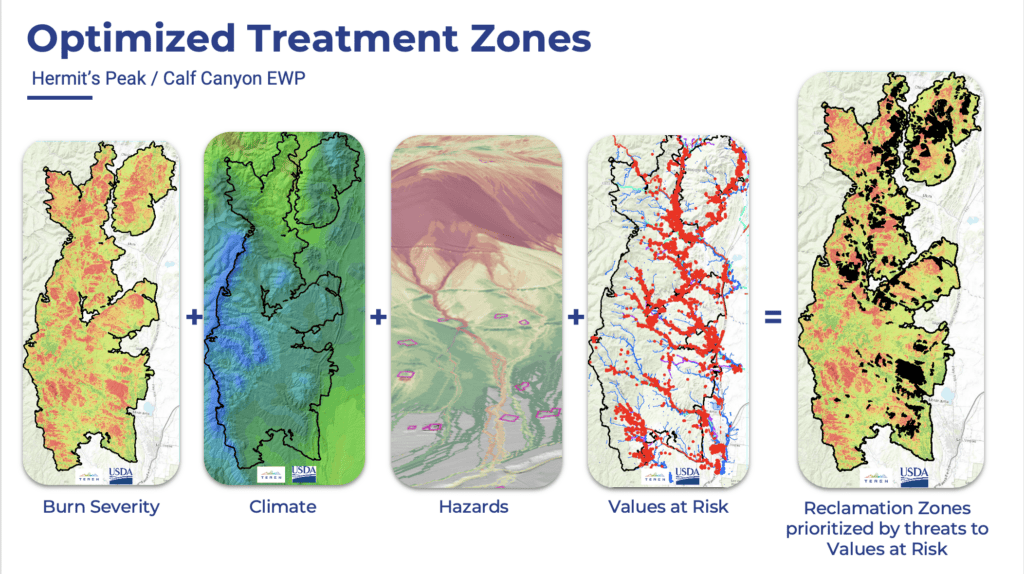
Teren Inc.’s spatial analysis tools have been pivotal in New Mexico’s wildfire recovery efforts. Using a 2-phase approach, high-resolution data and advanced modeling techniques, Teren has enabled a more precise, cost-effective, and efficient approach to rebuilding communities and restoring natural resources.
Phase 1: Mapping Wildfire Recovery Zones
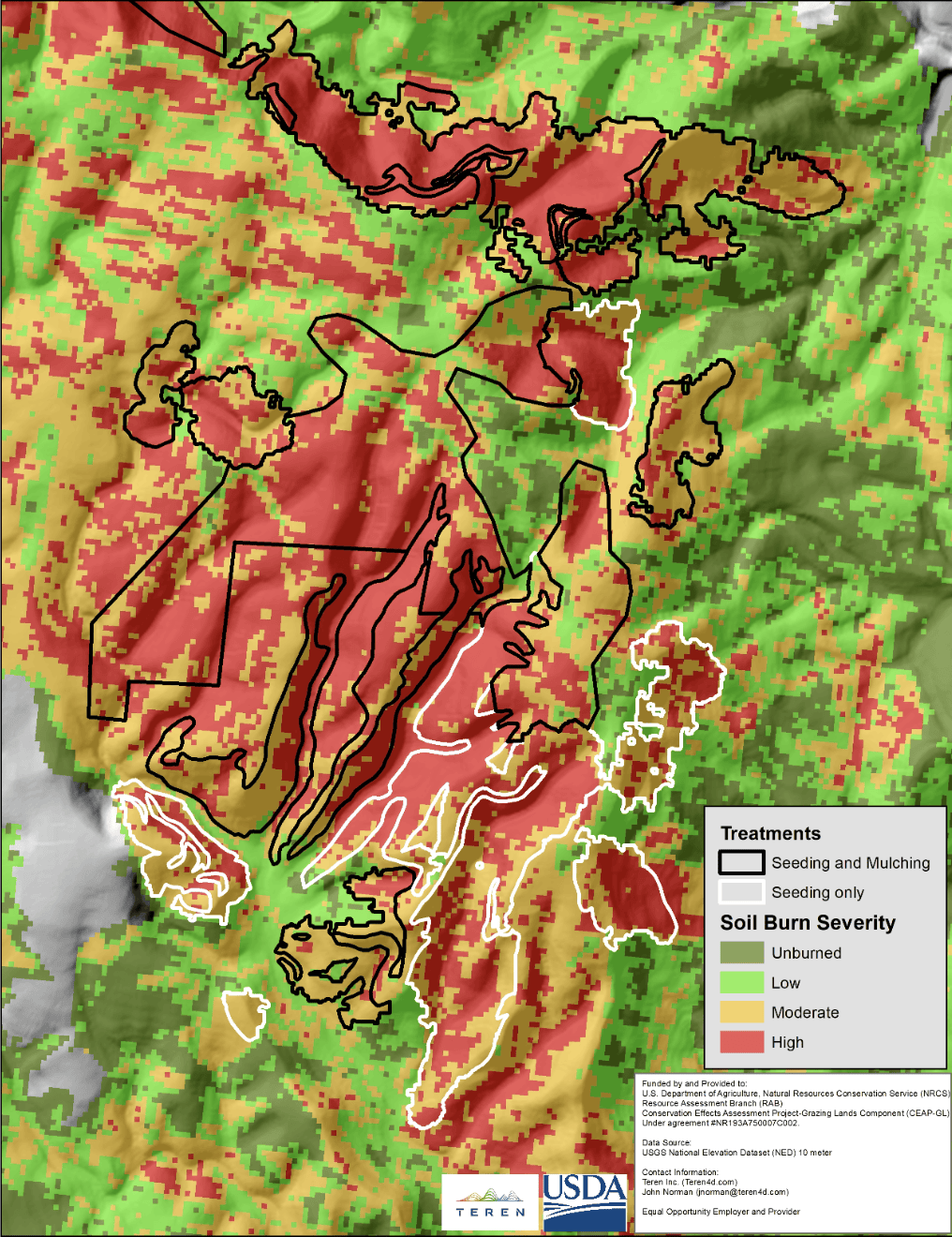
The initial phase involved providing maps and spatial data to NRCS teams within seven days to help triage potential hazards and assess degrees of risk. These maps, created using publicly available data, were crucial in identifying areas requiring immediate stabilization and conservation measures.
Importance of Slope Analysis
Understanding the slope of the terrain is vital in assessing potential hazards. Steeper slopes are more prone to erosion, particularly after a fire when soils become loose. Identifying slopes between 20% and 55% helps determine where stabilization efforts should be focused.
Micro-Watershed and Structural Analysis
Assessing treatment needs within a watershed context ensures proper scale and design of conservation measures. Identifying micro-watersheds (approximately 250 acres) and structures within the burn area allows for a comprehensive approach to stabilizing natural resources and reducing hazard risks.
Phase 2: Advanced Spatial Analysis
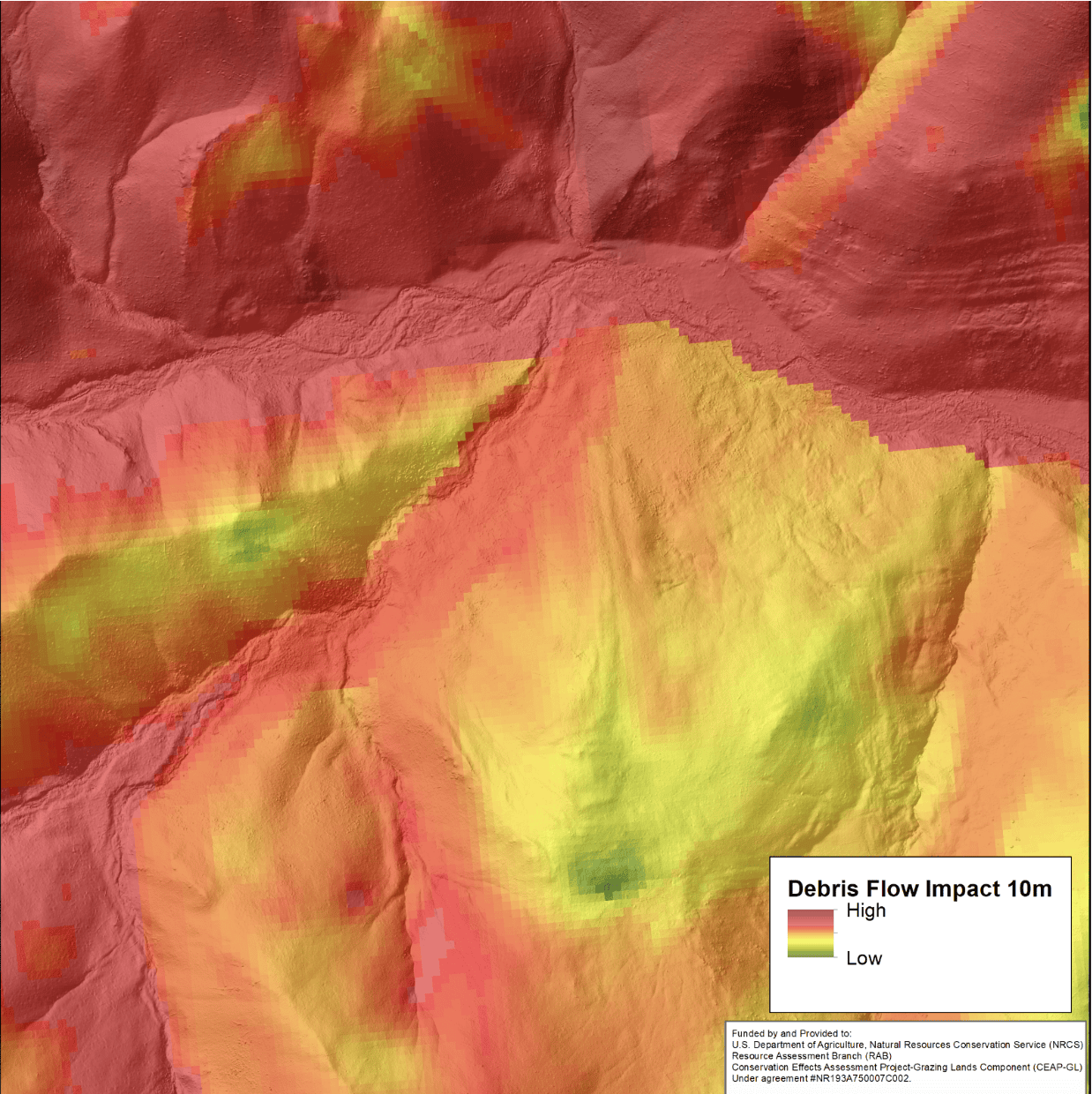
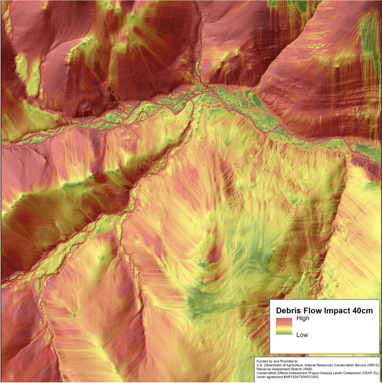
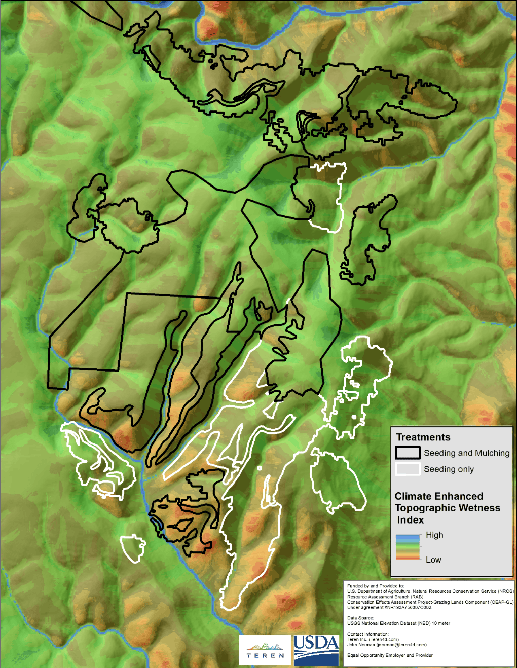
Eight days after project funding, Phase 2 began, leveraging high-resolution data for detailed spatial assessments. This included using 40cm LiDAR and 15cm 4-band imagery (blue-green-red-infrared) to analyze soil loss, woody debris volumes, and potential impacts on infrastructure. Teren’s Climate-Enhanced Topographic Wetness Index (CETWI) further aided in identifying areas with high moisture potential for effective erosion control and conservation plantings.
Image Resolution and Scalability
High-resolution data is crucial for assessing large landscapes at field-relevant scales. Fine-resolution products (less than 1 meter) offer detailed insights necessary for targeted treatments, whereas coarser resolution products (greater than 10 meters) are more suited for regional assessments.
Climate-Enhanced Topographic Wetness Index (CETWI)
The CETWI model, developed by Teren and sponsored by the NRCS CEAP-Grazing Lands, identifies areas with greater terrain moisture potential, guiding where vegetation seeding would be most effective. By analyzing water flow patterns and moisture retention, CETWI helps determine optimal locations for erosion control structures and conservation plantings, enhancing the effectiveness of recovery efforts.
Hazard Tree Determination and Staging Areas
Post-wildfire, assessing the impact on individual trees is critical for hazard tree removal and future conservation. Using 40cm LiDAR data and 15cm color infrared imagery, Teren mapped the burn severity of each tree, aiding in identifying areas where hazardous tree removal was necessary. This data also helped determine staging areas for tree removal and estimated the volume of woody material for potential commercial use.
Result: Maps-Driven, Quantified Recovery Prioritization.
This mapping approach using high-resolution geospatial data was crucial in identifying areas requiring immediate stabilization and conservation measures:
- 800 structures prioritized of 8,500
- 100 road miles prioritized of 350
- 50 water bodies prioritized of 700
- 1200 perennial stream miles of 3,000
- 66 acequia miles of 170
Get Your Copy
For a detailed insight into the case study and to explore Teren’s methodology, download the full case study here.